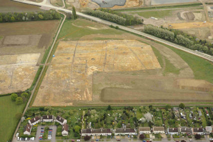
The archaeological excavation on Clay Farm looking east from Foster Road, to the Guided Busway with excavations underway in the field to the east of Foster Road. Oxford Archaeology East, 13 April 2011.
This is one of a series of pages about Clay Farm .
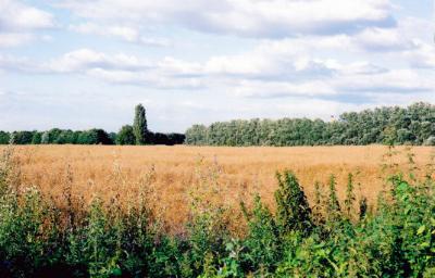
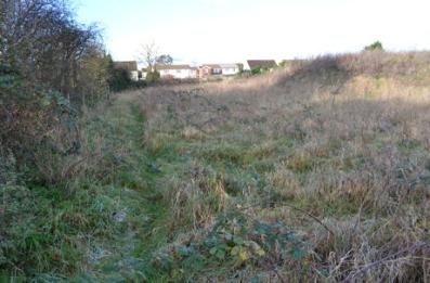
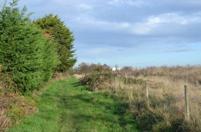
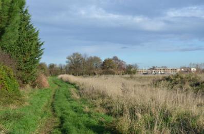
Field to the rear of Foster Road, looking towards the old railway line and the shelter belt and the track from Paget Close to Addenbrooke’s. Photo: Andrew Roberts, July and August 2007.
Archaeological excavation on Clay Farm looking east from Foster Road, to the Guided Busway with excavations underway in the field to the east of Foster Road. Oxford Archaeology East, 13 April 2011.
Field to the rear of Foster Road, looking towards the old railway line and the shelter belt and the track from Paget Close to Addenbrooke�s, July 2007.
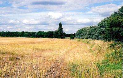
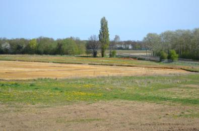
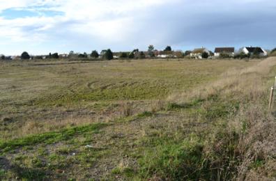
Harvested field to the rear of Foster Road, looking north east along old railway line and the shelter belt, towards the track from Paget Close to Addenbrooke�s, August 2007.
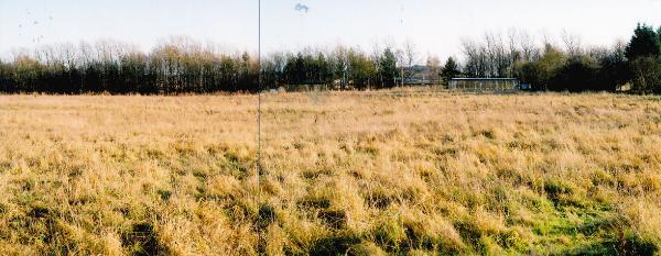
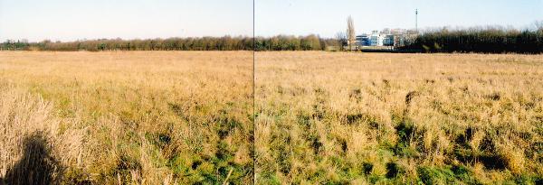
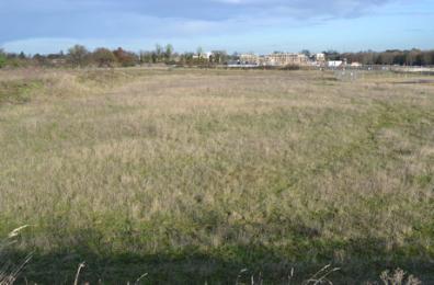
Panorama of Clay Farm from the rear of Foster Road, looking north and east from the chicken runs to the busway stop, 9 January 2011.
Panorama of Clay Farm from the rear of Foster Road, looking north and east from the chicken runs to the busway stop, 9 January 2011.
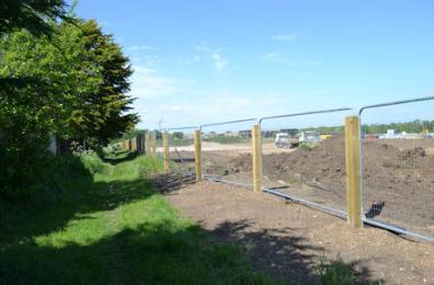
Clearing top soil from the field behind Foster Road prior to archaeological work, 24 February 2011.
Clearing top soil from the field behind Foster Road prior to archaeological work, 24 February 2011.
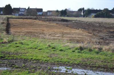
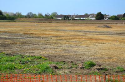
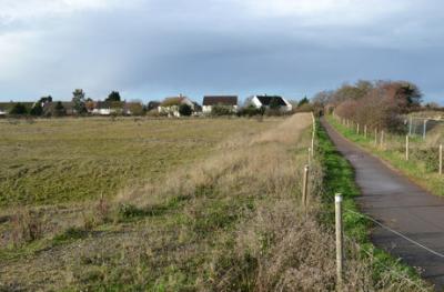
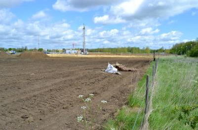
Looking across the Clay Farm fields from Foster Road towards Addenbrooke�s Hospital, with clearance in advance of archaeological work, 7 March 2011.
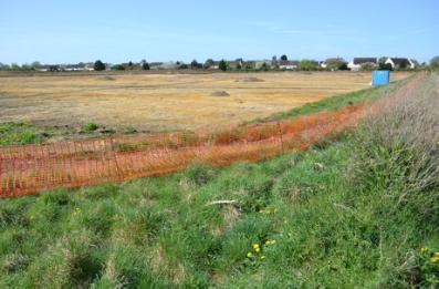
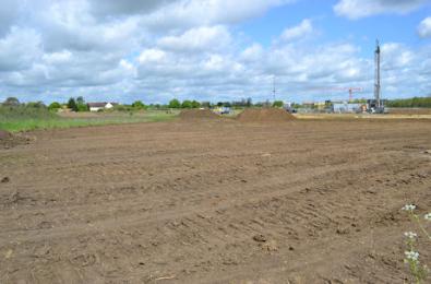
Looking from the CGB bus stop towards the fields behind Foster Road, with clearance in advance of archaeological work, 7 March 2011.
Looking from the CGB bus stop towards the fields behind Foster Road, with clearance in advance of archaeological work. Photo: Andrew Roberts, 7 March 2011.
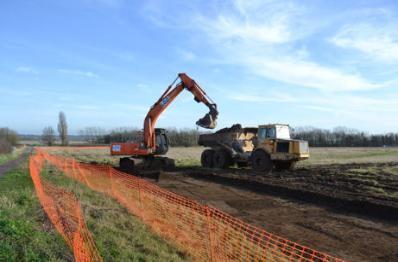
Looking across Clay Farm to Foster Road, from the footpath to Addenbrooke�s, during excavations, 10 April 2011.
Looking across Clay Farm to Foster Road, from the footpath to Addenbrooke�s, during excavations, 10 April 2011.
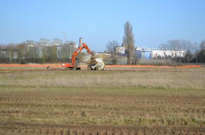
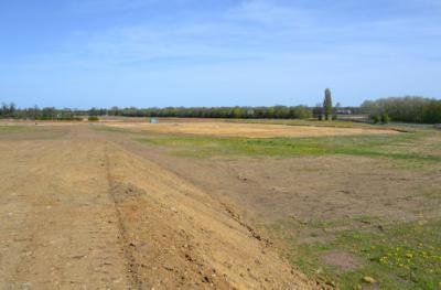
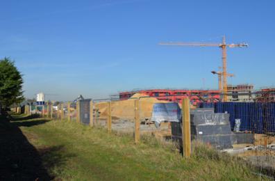
Looking north across the Clay Farm fields and the archaeological excavation, from the topsoil heap to the rear of Foster Road, 10 April 2011.
Looking northeast across the Clay Farm fields to the poplar trees, from the topsoil heap to the rear of Foster Road, 10 April 2011.
Looking northeast across the Clay Farm fields to the poplar trees, from the topsoil heap to the rear of Foster Road. Photo: Andrew Roberts, 10 April 2011.
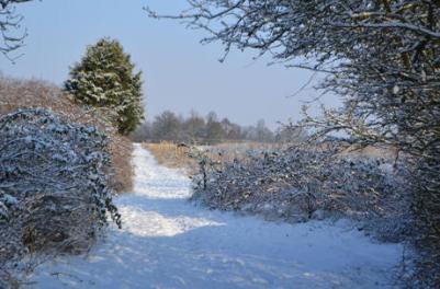
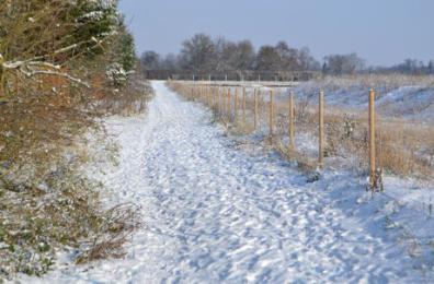
The path behind Foster Road after snow, 10 February 2012.
The path behind Foster Road after snow, 10 February 2012.
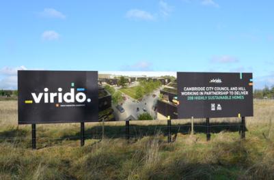
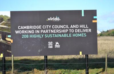
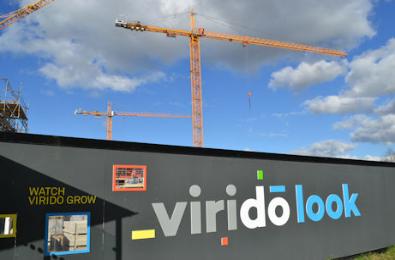
Marketing sign for Virido, Clay Farm, 17 November 2014.
Marketing sign for Virido, Clay Farm, 17 November 2014.
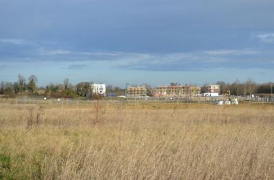
Looking across the Virido area towards the Aura development, Clay Farm, 8 December 2014.
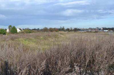
The rear of the chicken area and the Virido site, Clay Farm, 8 December 2014.
The rear of the chicken area and the Virido site. Photo: Andrew Roberts, 8 December 2014.
Looking across the Virido site towards Foster Road and the Aura development, Clay Farm, 8 December 2014.
Looking across the Virido site towards the Aura development, Clay Farm, 8 December 2014.
Looking across the Virido site towards the Aura development. Photo: Andrew Roberts, 8 December 2014.
Looking along the path to the rear of Foster Road, Clay Farm, 8 December 2014.
Looking along the path to the rear of Foster Road towards the Aura development, Clay Farm, 8 December 2014.
Looking along the path from Trumpington to Addenbrooke�s towards Foster Road, with the Virido site to the left, Clay Farm, 8 December 2014.
Looking from the path from Trumpington to Addenbrooke�s towards Foster Road, with the Virido site, Clay Farm, 8 December 2014.
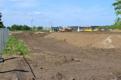
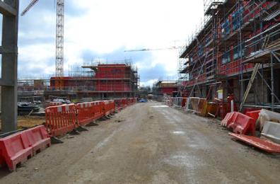
Ground clearance and fencing on the Virodo site, with work on the square and community centre in the background, 12 May 2015.
Ground clearance on the Virodo site, with work on the community centre in the background, 12 May 2015.
Groundworks on the Virido site to the rear of Foster Road, Clay Farm, 21 May 2015.
Groundworks on the Virido site to the rear of Foster Road, Clay Farm, 21 May 2015.
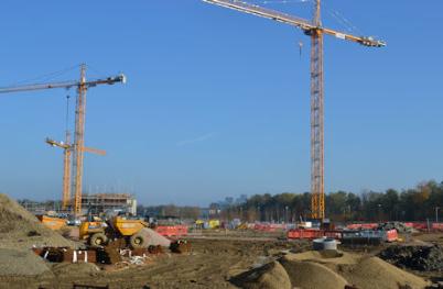
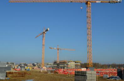
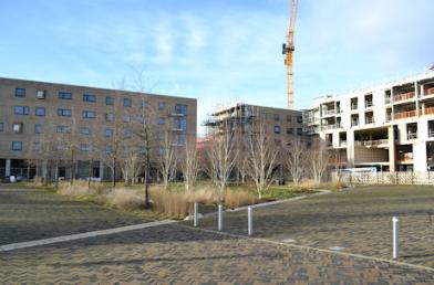
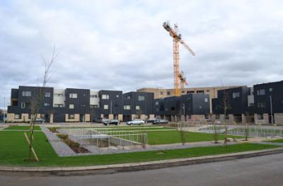
Cranes over the Virido site and the Clay Farm Centre. Photo: Andrew Roberts, 1 November 2015.
Cranes over the Virido site and the Clay Farm Centre, 1 November 2015.
Cranes over the Virido site and the Clay Farm Centre, 1 November 2015.
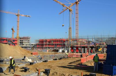
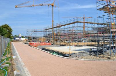
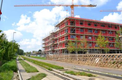
Progress with the Virido development, from the path to the rear of Foster Road. Photo: Andrew Roberts, 16 February 2016.
The path to the rear of Foster Road, alongside the Virido development. Photo: Andrew Roberts, 16 February 2016.
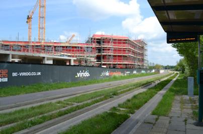
The Virido development, through the hording near the path to the busway. Photo: Andrew Roberts, 4 March 2016.
The Virido development, through the hording near the path to the busway. Photo: Andrew Roberts, 4 March 2016.
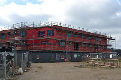
Progress with apartments to the rear of the Clay Farm Centre on the Virido development. Photo: Andrew Roberts, 6 March 2016.
Progress with apartments to the rear of the Clay Farm Centre on the Virido development. Photo: Andrew Roberts, 6 March 2016.
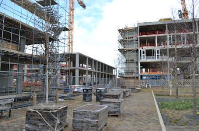
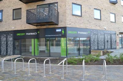
Shop units in the Virido development and the Clay Farm Centre from Hobson Square. Photo: Andrew Roberts, 6 March 2016.
Shop units in the Virido development and the Clay Farm Centre from Hobson Square. Photo: Andrew Roberts, 6 March 2016.
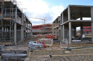
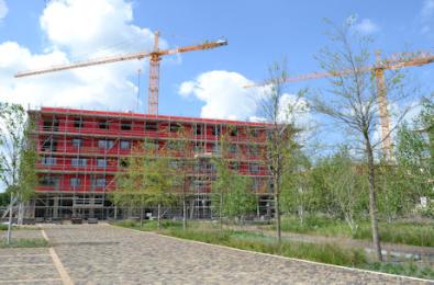
The Virido development from Hobson Square. Photo: Andrew Roberts, 6 March 2016.
The Virido development from footpath to the rear of Foster Road. Photo: Andrew Roberts, 8 May 2016.
The Virodo development from Hobson Square. Photo: Andrew Roberts, 15 May 2016.
The Virodo development from Hobson Square. Photo: Andrew Roberts, 15 May 2016.
The Virodo development from the busway stop. Photo: Andrew Roberts, 15 May 2016.
The Virodo development from the busway beside Hobson Square. Photo: Andrew Roberts, 15 May 2016.
The Virodo development from the busway beside Hobson Square. Photo: Andrew Roberts, 15 May 2016.
Virido development from the busway stop. Photo: Andrew Roberts, 11 December 2016.
Progress with the Clay Farm Centre and the Virido development around Hobson Square. Photo: Andrew Roberts, 11 December 2016.
Progress with the Clay Farm Centre and the Virido development around Hobson Square. Photo: Andrew Roberts, 11 December 2016.
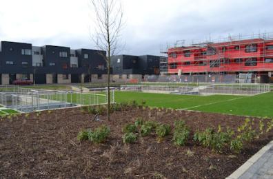
The central square, construction work on Pychard Road and newly completed homes on Hartree Lane, Virido development. Photo: Andrew Roberts, 26 February 2017.
The central square, construction work on Pychard Road and newly completed homes on Hartree Lane. Photo: Andrew Roberts, 26 February 2017.
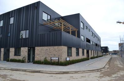
Newly completed homes on Dobson Way and Harradine Street, Virido development. Photo: Andrew Roberts, 26 February 2017.
Metalwork on homes on Drury Avenue, Virido development. Photo: Andrew Roberts, 2 March 2017.
Newly completed homes on Dobson Way and Harradine Street. Photo: Andrew Roberts, 26 February 2017.
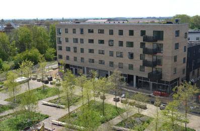
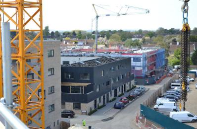
Looking from the roof of the Clay Farm Centre, onto Hobson’s Square and Virido. Photo: Andrew Roberts, 19 April 2017.
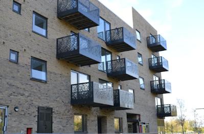
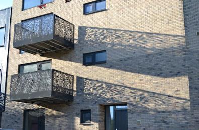
Metal balconies on the Virido development alongside the Busway. Photo: Andrew Roberts, 9 April 2017.
Metal balconies on the Virido development alongside the Busway. Photo: Andrew Roberts, 9 April 2017.
Looking from the roof of the Clay Farm Centre, west over Virido and the estate. Photo: Andrew Roberts, 19 April 2017.
Looking from the roof of the Clay Farm Centre, west over Virido and the estate. Photo: Andrew Roberts, 19 April 2017.
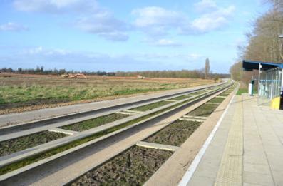
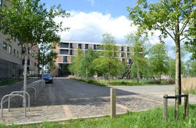
The Busway bus stop and bike shelter with the completed Virido housing. Photo: Andrew Roberts, 24 December 2017.
Hobson Square, with completed Virodo development to the left . Photo: Andrew Roberts, 10 May 2018.